Our Great Rivers
Our Great Rivers is a collaborative, comprehensive 30-year vision for the Chicago region’s waterways. Together we are reconnecting communities and their rivers. This vision includes 26 distinct goals to create rivers that are more inviting, productive, and living, with each goal framed by a decade: 2020, 2030, and 2040. There’s been great progress and achievements since the vision’s release in 2016 with many government agencies, nonprofits, and community partners implementing projects, policies, and activations to collectively advance this vision.
Issue
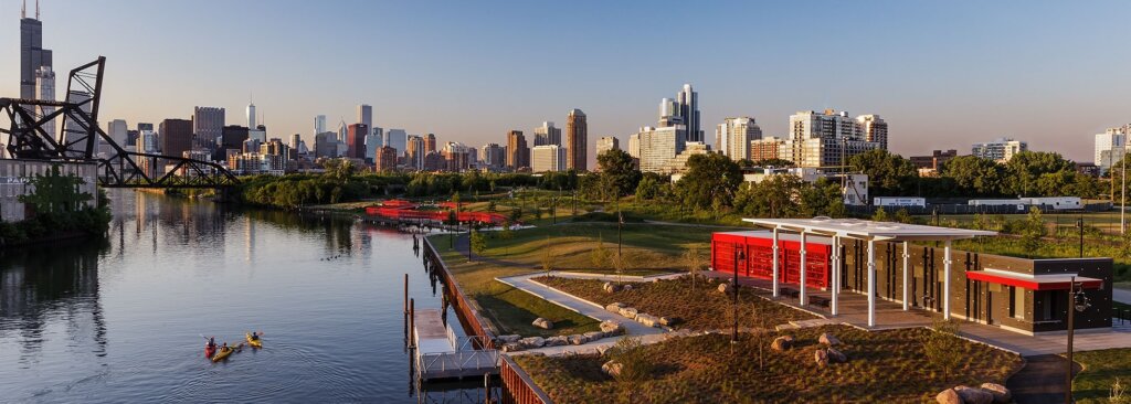
The Chicago, Calumet, and Des Plaines rivers are three of our city’s greatest assets. Investments such as new boat houses and riverbank restoration are helping people in the Chicago region change the way they think of and experience our rivers. The appetite is strong for more comprehensive land use planning along our riverfronts for improvements to open space, recreation, and community and economic development.
Visit the interactive Explore Our Great Rivers Story Map to learn about riverfront projects across the City.
Solutions
The Our Great Rivers vision—by 2040, Chicago’s rivers will be Inviting, Productive and Living places where everyone can have their own experience—was articulated by thousands of stakeholders through an intensive 18-month, citywide visioning process led by the Metropolitan Planning Council, in partnership with the Office of the Mayor of the City of Chicago, Friends of the Chicago River, and more. Our Great Rivers lays out discrete goals for 2020, 2030, and 2040, enabling us to monitor progress toward achieving Inviting, Productive and Living rivers. It also articulates a need to determine new revenue streams and leadership collaborations for the rivers to ensure that this vision is realized and can endure.
Our vision is now becoming a reality. Today, Great Rivers Chicago focuses on engagement around policy and planning objectives through the City of Chicago’s River Ecology and Governance Task Force as well as providing support to community-led projects up and down Chicago’s rivers. The recently released Calumet Data Book is an example of how collaborative, place-based projects have the potential to influence longer-term policy goals around riverfront land uses. By combining a comprehensive policy and planning approach to Chicago’s rivers and riverfronts with the implementation of individual projects, we can collectively achieve the Our Great Rivers vision.
Calumet River
South Branch
Benefits
Celebrate and enhance existing assets: Chicagoans are reimaging the river systems as our city’s Second Coast. Raise awareness of the river’s trail system and build upon what exists to create a connected riverfront trail from Devon Avenue to Western Avenue that rivals Chicago’s Lakefront Trail.
Spark neighborhood development: Our rivers and riversfronts should be places that celebrate and showcase local neighborhoods by providing activities to bring communities together. Equip local stakeholders with the tools to take on their own placemaking initiatives on their riverfront.
Build consensus: River users vary and sometimes have competing priorities. Through collaboration, build consensus to create a river system that is Inviting, Living and Productive.
Guide future development: Update riverfront development guidelines to reflect the collective vision in future developments.
Reinvigorate existing plans and initiatives: Bring existing initiatives together to spark new momentum leading to implementation.
Learn more
Collaborators
- City of Chicago
- Friends of the Chicago River
- Chicago Metropolitan Agency for Planning
- Active Transportation Alliance